Quantcast
Channel: Atlas Obscura: Articles
Viewing all 11432 articles
Browse latest View live

The Rusted, Rotting Remains of A New Jersey Missile Base

0
0

article-image
A Nike missile on a launcher. It could reach speeds of 1,700 mph in just 4 seconds while carrying a 40KT warhead. (Photo: Luke Spencer)

On a narrow strip of heavily wooded land, ringed with beaches and jutting out six miles from the coast of Northern New Jersey into the Atlantic Ocean, sits a remarkable secret.

At first, it looks like the top deck of an aircraft carrier. An old iron barbed wire fence surrounds the giant slab of concrete, which is hidden in layers of undergrowth. Faded yellow-painted markings, what looks like long rusted bay doors, are embedded into the floor. Old loudspeakers and disused arc lamps mark the perimeter. 

This was one of the most highly classified, top secret locations in the United States, a Nike missile base called Fort Hancock. If you were caught anywhere near it in the last 50 or so years, the heavily armed patrols had orders to release their vicious attack dogs and shoot to kill on sight. Now in ruins, these forgotten remnants were New York’s last line of defense against Soviet nuclear attack. 

article-image
The remains of the Nike launch site at Fort Hancock. Missiles would emerge from underground to neutralize the Soviet threat. (Photo: Luke Spencer)

Named for the Greek winged goddess of victory, and developed by Bell Telephone Laboratories, the Nike missile was a surface-to-air missile, guided by radar and a tracking computer. The program started in 1945, spurred by two cataclysmic events: the first successful atomic bomb test by the Soviet Union and their development of a long range bomber capable of 10,000-mile distances. The threat of Soviet aircraft carrying atomic weapons suddenly became very real. The Nike missiles were a solution to prevent another Pearl Harbor from happening.  

The radar system would constantly monitor the skies for Soviet planes, while another radar would lock onto any plane invading U.S. airspace, and track it. The radar would co-ordinate with the missile’s computer to zero in on the plane and destroy it. 


article-image
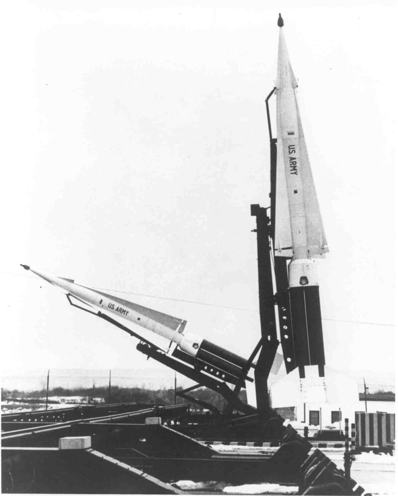
Nike Hercules missiles at Fort Hancock in the firing position. (Photo: NPS/GATEWAY NRA Museum Collection) 

article-imageA drawing showing data flow of radar at control area from 'Procedures and Drills for the NIKE Ajax System,' 1956 (Photo: Library of Congress) 

Western Electric began manufacturing the system with the missiles engineered by Douglas Aircraft. The first version called the Nike Ajax was ready to be deployed by 1954. It was superseded in 1958 with the even more powerful Nike Hercules. They were situated in hidden batteries surrounding America’s most important strategic cities, in what the U.S. Army Ordnance brochure called“Rings of Supersonic Steel”.  By 1963 there were over 200 Nike sites defending the U.S. against the threat of Soviet annihilation. Los Angeles, home to most of the U.S. aerospace industry, was a principal target, as was Chicago and Indiana, which had the bulk of U.S. steel. According to a well-sourced Wikipedia list, New York had 19 missile sites to protect it should the unthinkable happen. 

article-image
The Nike missile family in the 1960s. (Photo: Public Domain/WikiCommons)

Launch sites were divided into three main areas, which had to be at least 1,000 yards apart. The radar system, a camp of barracks and mess halls for the 100 men who manned the base, and the missile silos themselves. Often the missile sites were built on existing military installations, which meant that in New York City, many 19th century forts built to protect the city with more conventional heavy artillery were repurposed into Nike sites. (Fort Totten and Fort Tilden, for example.) Due to their brief, the sites had to surround the city they were designed to protect, so many Nikes were secreted away in the backyards of Long Island, Westchester, and the potter’s field of Hart Island. The sites were hidden, with good reason, since the Hercules missile was armed with a "Big Red" nuclear warhead with a yield of about 30 to 40 kilotons of TNT. (The bomb that obliterated Hiroshima was 13 kilotons.) Military security surrounding the sites had zero tolerance for intruders.

article-image
The remains of the Nike radar installation at Fort Hancock that would track enemy craft and guide the missile to it. (Photo: Luke Spencer)

Sandy Hook in New Jersey proved to be an ideal site. Close enough to New York, but remote enough, it had long provided the perfect strategic position for guarding entry into New York harbor due to the deep channel that ran alongside it. Home to America’s oldest lighthouse, the slender spit of land had been fought over since the days of the War of Independence. 

The original Fort Hancock was improved upon during the Civil War, and in the 1890s vast concrete gun batteries and mortar pits were built to protect Manhattan. At one point over 7,000 soldiers lived here in an army town that included rows of grand yellow brick homes, officer’s quarters, a theatre and ball fields. The full-scale camp was largely vacated after World War II and given over to a Nike launch site given the code name NY-56.

article-image
A Nine Gun battery firing at Fort Hancock in 1941. (Photo: NPS/GATEWAY NRA Museum Collection) 

article-image
One of the original houses from when Fort Hancock was first built. At one point over 7,000 soldiers lived in this remote town. (Photo: Luke Spencer)
 

article-image
The abandoned 19th century battery emplacements, designed to protect Manhattan. (Photo: Luke Spencer)

This launch site borders one of the beaches at the far end of Sandy Hook. The nuclear missiles would have been housed underground in silos about the size of a school gymnasium, from where they would emerge should the threat of a Soviet atomic assault on Manhattan appear on the horizon. As the Army brochure put it:

“The silent sentinels of Nike stand ready for that day, a day we all hope many never come. We must be ready to protect ourselves with the newest weapons science can provide.”

These “newest weapons” came at a cost of billions of dollars as sites sprung up all over America. 

About 1,000 yards from the launch site was the radar complex. Today, hidden from view by the forest of the peninsula, the radar guidance systems resemble giant seashells, perched upon rusting squat platforms, looking not unlike they were placed in the forest by the Dharma Initiative.

article-image
 "Whatever tomorrow may bring.....NIKE will be watching, always ready." Constantly monitoring for Soviet bombers. (Photo: Luke Spencer)

From here the skies were constantly monitored with the official “tactical control” orders in place should the unthinkable happen. A VHF radio message would raise the alarm with the words “BLAZING SKIES : THIS IS NOT A DRILL” broadcast throughout the base, over the now silent loudspeakers surrounding the launch site. “Blazing Skies” was the code words for “aggressor engagement”. 

By the 1970s however, the Nikes were rendered obsolete. The advent of the Inter-Continental Ballistic Missile gave way to a new form of terror; a Soviet nuclear attack that didn’t require aircraft. With the ongoing war in Vietnam consuming the bulk of defense expenditure, the Nike program was shelved in 1974’s Strategic Arms Limitation Talks agreement. No Nikes were ever launched in anger over US soil, but the program wasn’t without casualties. In Leonardo, New Jersey, an Ajax missile exploded on May 22nd, 1958, killing six soldiers and four civilians.

What, then, happened then to the Nike missile launch sites? Today there are remnants of around 250 bases around the United States in varying levels of ruin. Those built on existing Army bases were simply decommissioned. Due to their proximity to major cities, some were sold to school districts, or turned into municipal yards. Others found their way into private use and became paintball sites. Some were turned into homes. In Virginia, one base even became a prison.

article-image
Waiting for the Blazing Skies call that would alert that an attack was imminent. (Photo: Luke Spencer)  

“They are disappearing, dug up, and houses are built on it, and pretty soon there aren’t going to be any of them around,”  David Tewksbury, a GIS specialist told Livescience.

Today only a few remain intact. The problem of historic preservation arises due to the relative modernity of the sites. Cold War era structures aren’t as easily protected on the National Register of Historic Places. With no official efforts made to preserve the sites it is left to such volunteer groups as the Cold War Veteran’s Association who are striving to protect and restore the bases in Lorton, VA and LA-43 in California.

With most of the original structures still there, they offer tours of the old radar sites, often given by actual Nike veterans who were based there. Visitors have the opportunity to tour inside the radar sites and “find out what it was like to go on full alert”. The launch site, however, would greatly benefit from more funding and protection. Today it silently rusts away, watching the skies over New York for the attack that never comes.


100 Wonders: Is the House on the Rock a Great Hoax or Great Art?

0
0

The House on the Rock is unlike any other place in the world.

The dwelling, perched on a column of rock in Spring Green, Wisconsin, bills itself as containing "visionary architecture, eclectic collections and incredible stories." It's hard to wrap your brain around what the place contains: the world's largest indoor carousel, cases upon cases of antique armor, cars, guns, mechanical parts from a brewery, the list goes on and on.  It is a location of such profound strangeness that fantasy author Neil Gaiman chose to make it a portal into the minds of the gods in his novel American Gods. In Gaiman's words, "It's a monument to kitsch and wonder and madness and uncertainty...I had to tone down my description of it and leave things out in the book in order to make it believable."  You will find your sense of reality altered by the experience of entering the house, whose wonders are so numerous, it's almost too good to be believed. 

To see more of Atlas Obscura's videos check out our Youtube page, and click here to subscribe!

Places You Can No Longer Go: Berliner Stadtschloss and Palast Der Republik

FOUND: A Jupiter-Sized Exoplanet, Discovered by a Teenager

0
0

article-image 
An artist's rendering of WASP 142b (Image: David A. Hardy)

Most 15-year-olds spend their time searching for things more mundane than exoplanets. But while interning at Keele University, in England, one teenager found "a tiny dip in the light of a star," the university says. It looked like it might be evidence of an exoplanet—a planet orbiting a star other than the sun. This one was 1,000 light years away from the Milky Way. 

Two years later, Tom Wagg is 17, and it's finally official: He discovered a new exoplanet, now named WASP 142b. In the past few years, scientists have been finding planets all over the universe at an incredible clip—earthlings have now documented more than 1,000 other planets circling around other stars.

Wagg's planet is large, about the size of Jupiter, the university says, and has a super-fast orbit, just two days in length. But it's most notable because of the youth of the person who discovered it. Wagg hasn't even gone to university yet! The rest of us need to get cracking on our out-of-this-world discoveries.

article-image
Tom Wagg (Photo: Keele University)

Bonus finds: A Byzantine churchIce Age camel bones, 3,800-year-old statuettes of politicians in what's now Peru

Every day, we highlight one newly lost or found object, curiosity or wonder. Discover something unusual or amazing? Tell us about it! Send your finds to sarah.laskow@atlasobscura.com. 

Moose Milk and Hobbit Farms: 8 Examples of Outsider Agriculture

0
0

article-image
Solucar, Europe's largest solar power complex. (Photo: Koza1983/WikiCommons/CC BY 3.0)

When you think of a non-industrial farm you probably think of some bucolic, pastoral setting: dairy cows calmly chewing on hay, wheat fields swaying in the breeze, and horses relaxing in paddocks. What you probably don't think of are super-specialized farms to harvest power, or farms with a resident population of dangerous animals that aren't meant for eating.

From glowing solar towers in Seville and underground fish tanks in Milwaukee to moose being milked in Russia, these 8 farms certainly aren't your grandfather's pumpkin patch. Let’s take a look at how some of the strangest farms across the globe are shaking up one of the world's oldest professions.


1. SOLUCAR SOLAR POWER COMPLEX
Sanlucar la Mayor, Spain

article-image
PS20 and the heliostats up close. (Photo: Big Max Power (BMP)/Flickr

Approximately 20 miles west of Seville, Spain, lies Europe's largest solar power facility, Solucar. Established in 2007, the Solucar facility contributes hugely to Spain's energy budget—just over eight percent of homes in Spain are powered solely through solar.

Soaring a few stories above the Spanish plains, PS10 and its neighboring tower, PS20, are "solar furnace" towers. These towers are paired with a moveable array of mirrors called heliostats, which direct sunlight to a heat exchanger located at the top of the tower. The receiver converts the solar energy into steam, which drives turbines to produce electricity.

To get a sense of how huge this place is, PS20 uses 1,255 heliostat mirrors alone. The heliostats are re-positioned throughout the day in order to reflect the most sunlight possible.

article-imagePS10 glinting in the sunlight. (Photo: Álvaro C.E./WikiCommons/CC BY 3.0)


2. SAMUT PRAKARN CROCODILE FARM
Thai Ban, Thailand

article-image
Inadvisable behavior on the crocodile farm. (Photo: Sivakrit Saravit/WikiCommons/CC BY-SA 4.0)

Thailand: the land of spicy curry, sun-kissed beaches, and lush forests. Also, apparently, the land of men sticking their faces into the toothy maws of crocodiles. 

For only 300 baht (about $3.00 USD), visitors can gain entrance into the Samut Prakarn Crocodile Farm, where 60,000 crocodiles share precious real estate with Asian elephants, tigers, and an assorted range of monkey species.

If just looking at the animals from a distance doesn't suit your fancy, you can attend the world renowned crocodile show, where performers pester trained crocodiles by sticking their feet, head, arms, and other appendages into their mouths. 

article-image
The world-famous crocodile show. (Photo: Sivakrit Saravit/WikiCommonsCC BY-SA 4.0


3. HOBBITON
Matamata, New Zealand

article-image
Once home for a hobbit, now home for a sheep. (Photo: Tara Hunt/Flickr)

The Shire is a sheep farm. No, really—Hobbiton is a working sheep farm on New Zealand's North Island. It is also dotted with tiny hobbit houses (which the sheep have reclaimed), and served as the real-life setting of the Shire in the film adaptations of the Lord of The Rings trilogy.

Visitors can tour the working farm by foot or off-road vehicle. Though most of the hobbit houses used in the movies are roped off, visitors can pop in to the Green Dragon Pub to have a drink. It's the planet's only working pub located in a hobbit house - how could you miss that?

article-image
Bilbo's house. (Photo: Tom Hall/Flickr)

article-image
Hobbit houses everywhere. (Photo: Tara Hunt/Flickr)


4. TEHACHAPI PASS WIND FARM
Tehachapi Pass, California

article-image
Older generations of windmills. (Photo: Stan Shebs/WikiCommons/CC BY-SA 3.0)

One of the first large-scale wind farms in North America, the Tehachapi Pass Wind Farm is also one of the most important renewable power corridors in the country. Providing up to 800 million kilowatt hours of electricity, the farm exports power all over central California.

Because the farm was founded in the early 1980s, you can actually see multiple generations of windmills operating in one location. The size of the fan blades—directly correlated to the energy output of the windmill—has increased dramatically in the last thirty-odd years as our understanding of the physics involved with wind power has improved.

From the 45-foot-tall relics of the 1980s to the hyper-modern, highly efficient windmills arcing over 500 feet into the sky today, the Tehachapi Pass Wind Farm is a living testament to how far we've come in our dedication to renewable energy.

article-image(Photo: Ikluft/WikiCommons/CC BY-SA 3.0


5. KOSTROMA MOOSE FARM
Kostroma, Russia

article-image
Happy moose in Kostroma. (Photo: Alexander Minaev/WikiCommons/CC BY-SA 3.0)

Located on the banks of the Volga River deep in Russia is one of the strangest farms on the planet: the Kostroma Moose Farm

The farm is dedicated to the production of moose's milk, which comes from the 15 cows on site. The milk, rich in iron, selenium, zinc, and lypozyme, is then supplied to a local sanatorium, where it is used to treat peptic ulcers and a host of other medical conditions. 

Beyond the moose-milk operation, the farm is a research facility, as all of the moose are fitted with radio-transmitters in order to track and understand their behavior. Because moose are not a truly domesticated animal, the farm practices a technique called "moose ranching"—the animals are allowed to roam free in the forest during the summer once they reach a certain age. They voluntarily return to the farm in the winter in order to partake in daily feasts of steamed oats. 

article-image
Moose love on the farm. (Photo: Alexander Minaev/WikiCommons/CC BY-SA 3.0)

article-image
Moose milking. Yes, this is a real thing. (Photo: Alexander Minaev/WikiCommons/CC BY-SA 3.0)


 6. HOGPEN HILL FARMS
Woodbury, Connecticut

article-image
Part of Tufte's Continuous Silent Megaliths Series (Photo: pedrik/Flickr)

Welcome to the fascinating and bizarre world of Edward Tufte.

A Yale computer scientist and statistician, Tufte is devoted to bridging the divide between data visualization and physical art. His 284-acre farm, Hogpen Hill in Connecticut, is a whimsical ode to sculpture gardens and installation artwork.

Ongoing now is Tufte's Continuous Silent Megalith Series, for which he has created massive landscapes out of stacked boulders and coniferous trees. Open houses are held for one day a year only on the farm, so consider yourself lucky if you get to see these amazing pieces up close.

article-image
A Gulfstream trailer suspended on a pole on Edward Tufte's property. (Photo: David Smith/Flickr)

article-image
(Photo: David Smith/Flickr)


 7. PASONA O2 URBAN FARM
Tokyo, Japan

article-image
Underground gardening at the Pasona 02 Headquarters. (Photo: Henrik Moltke/Flickr)

The unassuming former bank vault turned global headquarters of Pasona, a Japanese headhunting (in the recruiting sense) firm, in downtown Tokyo carries a secret. Inside the office's basement lies one of the most innovative agricultural farms on the planet: Pasona O2 Urban Farm.

Created not only to provide nutritious and hyper-local meals for employees, the Urban Farm is also used to experiment with new technologies and provide training to young people interested in agricultural careers. Because of the absence of sunlight—it's underground, after all—Pasona O2 uses an array of high-tech artificial lamps. The crops are grown mainly through aquaculture, and, notably, without pesticides.

article-image
 Crops ranging from grains to broccoli are grown underground in Pasona O2. (Photo: Henrik Moltke/Flickr)

article-image
(Photo: Henrik Moltke/Flickr)


 8. GROWING POWER FARMS
Milwaukee, Wisconsin

article-imageInside the greenhouse of Growing Power. (Photo: Ryan Griffis/Flickr)

Who would have thought that a former basketball star could solve world hunger by fish-farming in North Milwaukee? Growing Power's CEO Will Allen, a MacArthur Genius grant winner, established his innovative farm in a derelict plant nursery greenhouse with the hopes of serving fresh foods to underserved local residents at a low cost. 

The key to Growing Power's success lies within its three-tiered aquaponics system. Live perch and tilapia are housed in a lower tank buried underground, and the wastewater from the fish tanks is recycled to watercress and tomato plants on the surface of the greenhouse, creating a highly efficient closed loop.

article-image
(Photo: Ryan Griffis/Flickr)

article-image
(Photo: Ryan Griffis/Flickr)

What Do Reservoirs Reveal When They Dry Up?

0
0

article-image 
Lake Powell drying up. (Image: NASA Earth Observatory/Dylan Thuras)

Lake Mead is shrinking. The Great Salt Lake is shrinking. The Salton Sea is shrinking.

Not just in the American West, but in Africa, Asia, and the sub-Arctic reaches of the globe, lakes are disappearing. There's not just one reason: it's a combination of agricultural overuse, drought, and climate change. The current, terrible drought in the American West could be just a hint of what's coming. In the next century, scientists have predicted that a megadrought will desiccate America's center and southwest, putting even more stress on freshwater lakes, particularly the reservoirs that were man-made to begin with.

And when these disappear, they reveal the secrets that had been hidden beneath the surface—now-useless infrastructure, once lively settlements, and, if they dry all the way, fine-grained and often alkaline dust that's picked up by the wind and blown across the surrounding area.

article-imageSalton Sea (Photo: Chris Wronski/flickr)

Although Lake Mead, Lake Powell, and other reservoirs across the West are used recreationally for fishing and boating, ultimately, they exist to supply water to cities that otherwise could not exist. As water levels drop, the infrastructure that serves that function is struggling. In Lake Mead, for instance, the water supply is shrinking so dramatically that that lake's level could dip below the intake pipes that siphon water from the lake to the Las Vegas Valley. As the Las Vegas Review Journal reports, the water authority that oversees the reservoir is getting ready to open the gate to a new intake tunnel—started 7 years ago, as a hedge against drought—that will keep water flowing to Nevada's desert cities.

Shrinking lakes have also revealed less life-critical wonders that humans left in the valleys flooded by rivers. As Lake Mead has receded, the foundations of St. Thomas, NV, emerged from beneath the water. In California, Texas, Utah and Oklahoma, too, long-abandoned towns have re-appeared. In Oklahoma City, Lake Hefner shrunk to half its capacity, so that a family could walk the foundations of a homestead not farmed since the Great Depression. In Texas, in 2011, the height of the drought there, Lake Meredith released a plane that had been lost in water since 1984, and Lake Buchanan coughed up the remains of a town called Bluffton. One cruise company made the best of the situation and offered a tour.

In Utah, the remains of a prehistoric site that settlers called Fort Moki is re-explored whenever Lake Powell gets low enough. In California, Lake Don Pedro gives up a gold mine; Lake Berryessa reveals a town called Monticello; a lower Lake Isabella exposes the town of Kernville; and Folsom Lake uncovers a settlement once called Mormon Island.

Usually, these ruins end up back below the surface of the lake when the worst of the drought passes. But sometimes lakes dry up altogether, whether because they're man-made lakes that are drained on purpose or because people have mismanaged them so badly that they shrink into nothing.

In those cases, what's revealed is the dry and dusty lake-bed—which can be a problem in its own right. If the Salton Sea dries up, for instance, the amount of dust that the wind blows up from the basin could increase by a third, the Pacific Institute reports. Dust might sound innocuous, but it can increase asthma rates, even if it's benign. Around California's Owens Lake, which was purposely drained in the early 20th century, locals have a named for the dust that blankets the area—"Keeler fog," after a town that borders the lake.

article-image
Owens Lake (Image: NASA Earth Observatory)

Ultimately, though, the most troubling secret that these shrinking lakes reveal is not infrastructure or abandoned towns or a dusty lake beds. It's that people are not doing very well at managing the water resources that keep us alive. There are only so many times that it's possible to add a new intake pipe to a reservoir. Eventually, the water could simply be gone—there could be nothing left to siphon.

Dorothy McKibbin: The Manhattan Project's Secret Weapon

0
0


article-image
Dorothy McKibbin hanging out with Robert Oppenheimer. (Photo: Courtesy of the Los Alamos Historical Society)

Oppenheimer. Fermi. Feynman. Groves. When most people think (or read) about who was behind the American effort to make the atomic bomb, these are the names that often come to the fore. But there is one lady who tied all of the scientists, technicians, and other figures together during their time at Los Alamos.

That woman was Dorothy McKibbin, the Atomic Secretary, the woman who kept the Manhattan Project’s secrets. Known as the Gatekeeper of Los Alamos, and later the First Lady of Los Alamos, Dorothy McKibbin worked as the secretary at the 109 East Palace office where those destined for top secret work on “The Hill” would have to check in.

During her 20 years in the position, McKibbin would rub elbows with nearly all those that entered Los Alamos to build one of the most destructive weapons ever created.


McKibbin’s life before she joined the Manhattan Project is almost as fascinating as what she did after. Dorothy Scarritt was born in Kansas City, Missouri in 1897, graduating Smith College in Massachusetts 1919 before travelling the world with her father, visiting Alaska, Europe, South America. Unfortunately, in 1926, McKibbin came down with what she described in a 1965 interview with journalist Stephane Groueff as “a touch of TB” (the interview is available to listen to in its entirety via the Atomic Heritage Foundation’s terrific “Voices of the Manhattan Project”). To get well, McKibbin traveled to the Sun Mountain rehab facility in Santa Fe, New Mexico where it was thought that the dry air, sunny weather, and lovely desert surrounds would help to heal tuberculosis sufferers. While she recovered, McKibbin became enchanted by the hot climate and pueblo culture of the area, taking up drawing and pottery while she was on bed rest. The treatments worked, and within a year she was cured of the disease, but had been infected with something that would come to define her later life: a love for the city of Santa Fe.

Shortly after leaving Sun Mountain, she married investment banker Joseph McKibbin, and the young couple relocated to St. Paul, Minnesota. In 1930 they had a son, Kevin, and the family looked to have a bright future ahead of them. Tragically, Joseph passed away from Hodgkins disease just a year after Kevin was born, leaving he and Dorothy to move on alone. Instead of moving back to her family home in Kansas City, McKibbin and her 11-month-old son moved back to Santa Fe.

Back in the city she loved, McKibbin took a job as a part-time bookkeeper for the Spanish-Indian Trading Company, a small business that represented local Native American artisans, selling their arts and crafts. McKibbin spent the next decade in the city, raising her son as a single mother, while she acquainted herself with the local landscape, becoming an involved member of the community and regular expert on Santa Fe.

As America entered World War II, the tourism economy in Santa Fe dwindled and the Spanish-Indian Trading Company went under in 1943. However at the same time, the U.S. military had chosen nearby Los Alamos for their top secret Manhattan Project, which brought all sorts of new strangers to Santa Fe. One of these strangers was Robert Oppenheimer, who would become the father of the atomic bomb.

article-imageMcKibbin, Oppenheimer, and a friend hang out in a field. (Photo: Courtesy of the Atomic Heritage Foundation)

After the trading company closed, McKibbin looked at taking a bank job despite her hatred of arithmetic. She went so far as to take a civil service exam for the position, which she flunked. Undaunted she took the test a second time and passed, tentatively accepting a job as a loan officer. Around this same time, an acquaintance she had met while recovering from tuberculosis, Joe Stevenson, had returned to Santa Fe as the manager of the mysterious “Project Y” that was bringing all sorts of new people to the city. Stevenson asked McKibbin if she would like to take a job as a secretary. When she asked him what the job would entail, and who it was for, he simply said he couldn’t tell her, but he did give her 24 hours to decide if she wanted the position. The next day McKibbin went to lunch at the popular La Fonda hotel with some friends and she saw Stevenson standing with another outsider associated with the project. Still undecided about taking the mystery job, she went to say hi, and that’s when she first met Robert Oppenheimer. McKibbin described the meeting in that aforementioned 1965 interview:

I saw Joe Stevenson. The time was running out when I'd say yes or no. I saw him with Dwayne Muncy, the man in the brown gabardine suit. We were just chatting. I saw a man approach us from the lobby. […] He had on a trench coat and a porkpie hat. He walked sort of on the balls of his feet. I think that he had a pipe in his mouth. He stopped. The two men introduced me. I did not get the name. I wouldn't have known anything about it if I had. He said about five words to them, and then he turned and went on. I turned to Joe Stevenson and said, ‘I'll take the job.’ [...]  I thought that anything with which a man of that magnetism was connected was what I would enjoy.

And with that, the Gatekeeper of Los Alamos was born. McKibbin began working as the receptionist for Stevenson’s wife, before becoming the secretary for Stevenson himself. Her office was located at 109 East Palace, one of the Santa Fe office spaces that Oppenheimer had rented out under the name, “Mr. Bradley.” Stevenson told her not to ask questions and set her loose organizing the droves of people and equipment that would pass through the Santa Fe checkpoint on their way to the secret Los Alamos facility.

Every worker, scientist, supply truck, and shipment had to pass through 109 East Palace to receive badges and get clearance to head to and from the hill, and McKibbin was the warm, smiling face that greeted each of them. As Alexandra Levy, Project Director at the Atomic Heritage Foundation describes it, no principal from the project could travel without checking in with McKibbin—even people like Enrico Fermi, the physicist, had to hand over his Los Alamos badge before moving between Manhattan Project sites. “So she basically controlled a lot of the movement,” Levy says, “She was pretty powerful in the context of the Manhattan Project.”

The administrative office at 109 East Palace became one of the hearts of the Manhattan Project, not just processing the comings and goings of the workers, but handling food and clothing rations for the families and staff. But beyond her expert administrative wrangling, McKibbin acted as a comforting presence to the civilians and military men who would arrive to the office with little-to-no idea why they had been transferred there. At the height of the project in 1943 and 1944, military “taxis” were leaving every hour on the hour to bring them to and from Los Alamos, and McKibbin’s office was fielding over 60 people a day and over hundred phone calls.

McKibbin’s knowledge of the local sites and culture made her indispensable among the workers at Los Alamos who turned to her for insight on where to visit and relax when they weren’t toiling away on their secret bomb. “Hers was the first friendly face that they saw, and many of the people who remember McKibbin talked about how polite she was, how friendly she was, how she helped put them at ease after their long trip,” says Levy. McKibbin even opened up her personal garden to multiple weddings for couples that met on the project.

article-image
McKibbin's security badge photo. (Photo: Federal Government of the United States on Wikipedia)

Of course as the wall between the top secret world of Los Alamos and the civilian world of Santa Fe, McKibbin also acted as defense against spies. While just about every inch of Santa Fe from nightclub to newstand was watched by plain-clothes Army intelligence agents, 109 East Palace was known as being the point office for Project Y, so it of course became a target for espionage. McKibbin recalled in that same 1965 interview, reporting people who would show up asking for passes or information. She even came to know famed Soviet spy Klaus Fuchs, who she recalled was often asked to babysit for families on the base.  

Even with all of her work at 109 East Palace, McKibbin also took the time to socialize with the members of the Manhattan Project and even struck up a fond relationship with Oppenheimer himself who came to greatly respect her for her work and attitude. They both had a seemingly overwhelming connection to the rugged lands around Santa Fe and Los Alamos. McKibbin was known to attend parties at his house in Los Alamos where the other scientists and their families would mingle.  

Yet for all of her access, as a civilian employee without a top secret security clearance, McKibbin was never made aware of what they were working on up on the hill. Of course by 1945, with the bombing of Hiroshima and Nagasaki, McKibbin had been able to piece together what they had been working on.

McKibbin continued working at the 109 East Palace office long after the research on the bomb was finished, as Los Alamos and the Manhattan Projects slowly came to light. She operated the office until 1963, processing people as they came to Santa Fe and Los Alamos to live and work, helping them find housing and get settled.

When the office finally closed McKibbin retired for good. The Atomic Secretary never moved out of Santa Fe, though, staying in the city and becoming as active and a vibrant member of both the local arts and historic preservation community, as she was while working at 109 East Palace. Her devotion to the city and the Manhattan Project she was given the title of “First Lady of Los Alamos,” as well as being deemed a “Living Treasure of Santa Fe.” She had left as big an impression on Santa Fe as it had made on her life.

article-imageMcKibbin revisits 109 East Palace. (Photo: Los Alamos National Laboratory)

Correction: In an earlier version of this article, Alexandra Levy was noted as the Program Manager for the Atomic Heritage Foundation, which has been corrected to reflect her job title as Program Director. 

The Ravenna, The Manticora and 11 Somewhat Lesser-Known Monsters

0
0

article-image
An average cyclops, picking some average human bones out of his teeth with a stick. (Image: Biodiversity Heritage Library/Digitized by University of California Libraries)

When you consider the world’s actual biodiversity, our fantasy menageries start to seem sparse. Sure, dragons, mermaids, and cyclops are cool enough—but why settle? What about all the horrific non-creatures that have vanished from the collective imagination, never to be feared again? Who remembers them?

Thank goodness for John Ashton. Born in 1834, Ashton was too late to map the globe, but too early to shoot for outer space or the deep oceans (or to work for Atlas Obscura). A contemporaneous review of his work describes him as, instead, an explorer of libraries—“he brings within the ken of the public the information and illustrations for which the explorer or the scholar has had to hunt for in out-of-the-way and half-forgotten volumes.” His books deal with narrow but gripping subjects: street ballads, the history of bread, and eighteenth century waifs, to name a few. But his greatest contribution to the field was doubtlessly Curious Creatures in Zoology, his 1890 attempt to preserve the concoctions, hallucinations, and other hopeful, fearful missteps ginned up by early naturalists.

article-image
Sometimes one mistake is enough to transform a gentle creature—this antelope isn’t far off, save for the fangs. (Image: Biodiversity Heritage Library/Digitized by University of California Libraries)

In the good old days, Ashton explains—before science, and photography—illustrations and long explanations were enough to convince the world that unicorns were out there. “Now that modern travel has subdued the globe, and inquisitive strangers have poked their noses into every portion of the world… gradually, the old stories are forgotten,” he writes in the volume’s introduction. “It is to rescue some of them from the oblivion into which they were fast falling, that I have written, or compiled, this book… a collection of zoological curiosities, put together to suit the popular taste of to-day”—taste that, judging by our modern interests, has not changed much in the past century. Here are eleven of his best rescues.


1. THE MANTICORA

article-image
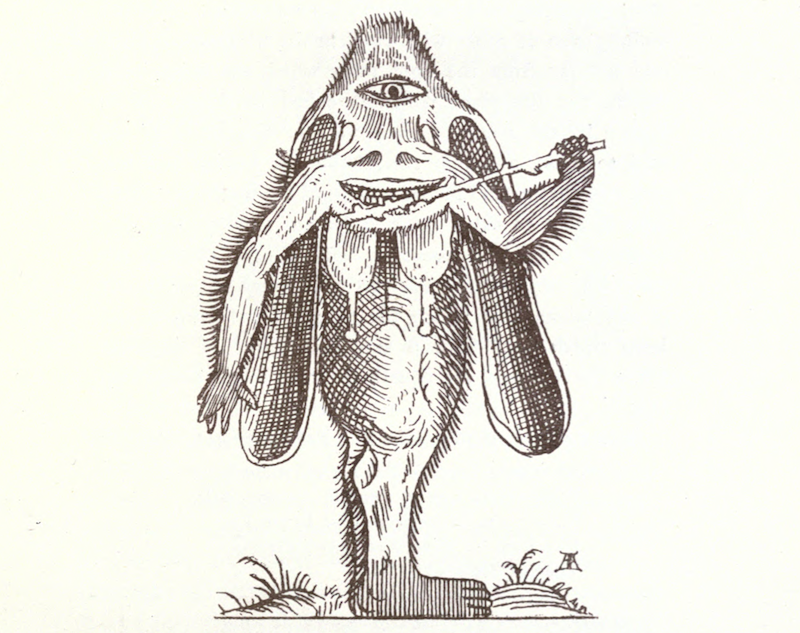
The Manticora, triple-smiling for its portrait. (Image: Biodiversity Heritage Library/Digitized by University of California Libraries)

According to Aristotle, this guy has all the fixin’s: face of a man, tail of a scorpion, big as a lion, fast as a stag, color of blood, “three rows of teeth in each jaw,” “utters a noise resembling the united sound of a pipe and a trumpet,” “is wild,” and “devours men.” It featured heavily in the nightmares of Victorian children.

2. THE RAVENNA

article-image
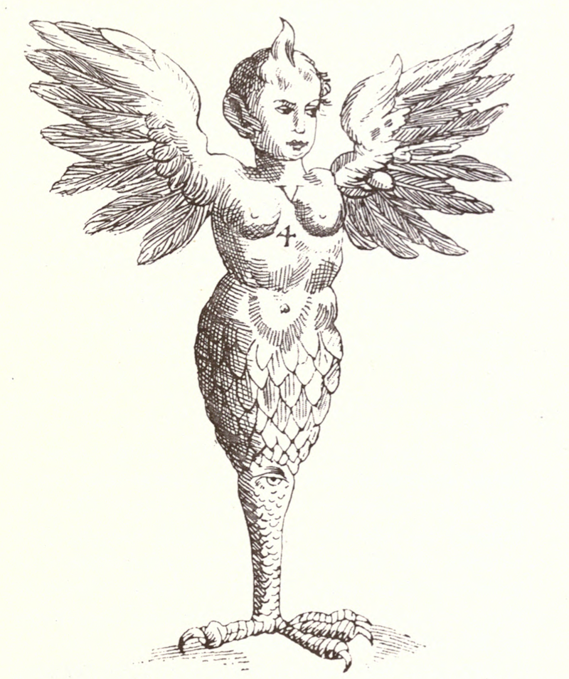
The Ravenna, with extra eyes to make up for its lack of limbs. (Image: Biodiversity Heritage Library/Digitized by University of California Libraries)


This monster was “born in Ravenna in 1511 or 1512” and was “of both sexes.” Despite its lack of arms, it did a lot of damage—according to a verse by Marcellus Palonius Romanus, its double identity meant it had no trouble threatening “double slaughter.” 

3. THE GORGON

article-image
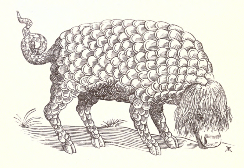
The Gorgon re-ups on poysonfull hearbs. (Image: Biodiversity Heritage Library/Digitized by University of California Libraries)

The Gorgon may look like a harmless, scaly cow, but don’t be fooled. “It eateth deadly and poysonfull hearbs, and if at any time he see a Bull, or other creature whereof he is afraid… sendeth forth of his throat a certaine sharpe and horrible breath, which infecteth, and poysoneth the air above his head, so that all living creatures which draw the breath of that aire are greevously afflicted thereby.”

4. THE LAMIA

article-image
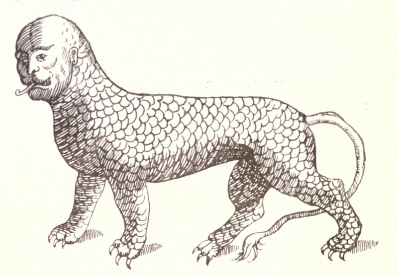
Beware the irresistible gaze of the Lamia. (Image: Biodiversity Heritage Library/Digitized by University of California Libraries)

The Lamia was originally an admittedly mythological creature, who seduced men and gods alike with her comely face and “pleasing hissings.” Later, though, Roman explorers were sure their real-life equivalents were eating shipwrecked soldiers in Libya.   

5. THE MIMICK DOG

article-imageThe Mimick Dog: Can you even tell it’s him, what with his mimicking skills? (Image: Biodiversity Heritage Library/Digitized by University of California Libraries)

Ancient authorities thought this dog was the offspring of a hedgehog and an ape. John Ashton is pretty sure he’s just a poodle. Regardless, he’s talented—he can “leap, play, and dance,” work as a servant, fetch and play dead.

6. THE SU

article-image
The Su, an overprotective monster mom. (Image: Biodiversity Heritage Library/Digitized by University of California Libraries)

A “cruell, untamable, impatient, violent, ravening, and bloody beast." When trapped by hunters, the Su would “roareth, cryeth, howleth, brayeth… uttereth a fearefull, noysome, and terrible clamor,” and eat her own cubs rather than let them be taken alive. 

7. THE FOUR-FOOTED DUCK

article-image
The Four-Footed Duck. (Image: Biodiversity Heritage Library/Digitized by University of California Libraries)

All that is known of the four-footed duck is that it has four feet. Somehow, though, that is enough.

8. THE LEONINE MONSTER

article-image
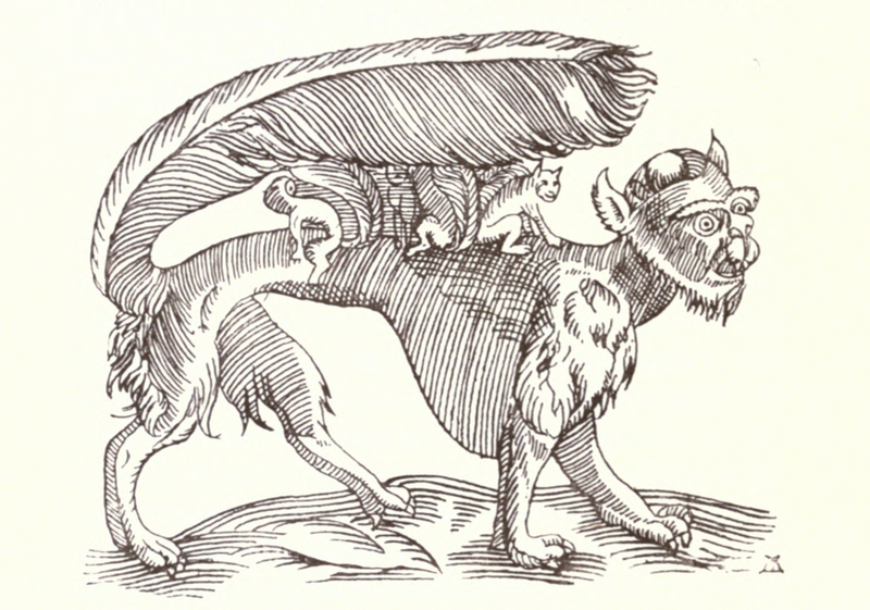
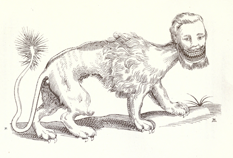
There is some confusion as to whether the Leonine Monster is an aquatic or a land creature. (Image: Biodiversity Heritage Library/Digitized by University of California Libraries)

Whoever drew this particular Leonine Monster apparently was a bad sketch artist—the original discoverer of the creature complained that he made the feet are longer than they ought to be, and the ears too large. He did not comment on the moustache, tail-claws, or pronounced cranium, so we should assume they’re correct. 

9. THE LAMB TREE

article-image
This Lamb Tree is not to be confused with the related lamb plant, on which tiny lambs grew in pods. (Image: Biodiversity Heritage Library/Digitized by University of California Libraries)

The life of a lamb tree was rough—it could only graze on the grass it could reach, and it was in constant danger of wolf attacks. Men could only kill it if they severed the stem with “well-aimed arrows or darts.”

 10. THE MOON WOMAN

article-imageThe Moon Woman examines one of her progeny. (Image: Biodiversity Heritage Library/Digitized by University of California Libraries)

The Moon Woman “lays eggs, sits upon them, and hatches Giants,” so just imagine how giant she must be.

11. THE BASILISK

article-image
The Basilisk “destroys all shrubs… it burns up all the grass too, and breaks the stones, so tremendous is its noxious influence.” (Image: Biodiversity Heritage Library/Digitized by University of California Libraries)

See the small crown on the Basilisk’s head? That’s because he is King of Serpents—“not for his magnitude or greatnesse… but because of his stately pace, and magnanimious mind,” and because he walks on eight legs instead of slithering. 


The Curse of the Bambino's Statue

0
0

article-image
Illustration by Matt Lubchansky.


In the summer of 1935, visitors to the Baltimore Museum of Art were privy to a real treat. The curatorial staff had just been loaned an impressive, eight-foot-tall statue of New York Yankees star (and Baltimore native) Babe Ruth. A towering golem meticulously crafted from a ton of clay by the noted American sculptor Reuben Nakian, the statue was a tribute to the Babe’s prodigious power, showing the slugger at the tail end of the home run swing that had made him an international icon. Now, at the height of the Babe’s fame, the museum had a jewel of a piece that would surely attract patrons from all over.

It was, as New York Sun noted at its initial unveiling in Manhattan a year earlier, sure to “survive down the shadowy arches of time.”

But after 1935 all information about the statue’s whereabouts is gone. The disappearance was never solved, and few clues remain about who might have been responsible. To many historians, even hardcore sports fanatics, it’s like it never even existed.

“I'd never heard of it,” says Shawn Herne, director of development and chief curator of the Babe Ruth Birthplace Foundation in Baltimore. “My executive director, who's been here since the early 1980s and is one of the foremost Babe Ruth experts — MLB consults with him on stuff — he had never heard of it. After so many years, you think you've heard all the Babe Ruth stories and come across all the Babe Ruth stuff, but this was a new one." 

The Baltimore Museum of Art has no idea what happened to the statue. “We have no records of where it went after it was here because it wasn’t ours to loan,” says Anne Mannix-Brown, a spokesperson for the BMA. “That would have been coordinated by the owner — probably the artist, in this case.”

Nakian died in 1986 — his New York Times obit, in citing his portraiture, called the Ruth statue “his most famous work in this mode” — but his son, Paul, has been actively investigating the statue’s fate for nearly 20 years. Now 78, Paul still lives in Stamford, Connecticut, where the Nakians settled in 1945. He’s realistic about the statue’s probable fate — the odds of an eight-foot-tall plaster statue surviving 80 years without expert preservation are slim — but he holds out hope it may yet turn up.

“My father went on to do things that are more exotic, but as a representational piece, the Ruth statue is a great work,” Paul Nakian says. “But could it really remain undiscovered after all these years? It's hard to believe that.” 


 article-image
Sculptor Reuben Nakian. (Photo: © Lois Dreyer)

For Reuben Nakian, the inspiration to sculpt a likeness of Ruth came on September 30, 1927, as he sat in the stands at old Yankee Stadium and watched the Bambino smash his record 60th home run of the season. It would be six more years before he started work on the piece but, as Nakian’s official site contends, “the excitement of this day remained imprinted on his mind.” 

Nakian began the project in 1933 and completed it in early 1934. At eight feet tall, the clay statue, cast in plaster, was literally larger than life and accentuated and amplified every one of Ruth’s features: his biceps, his legs, even his face. With the Babe shown in full contortion and balanced on his pivoting feet as he watches a home run sail away, the sculpture is captivating but in a mythological, comic book-type sense. He is almost impossibly muscular, but the author James Mote, who has written extensively on baseball artifacts, has called it “possibly the finest example of heroic sculpture ever created of a baseball subject.”

Promotional fliers invited the public to come down to the famed Downtown Gallery at 113 West 13th Street from February 13th to March 3rd. After that, “Babe Ruth” was put on display inside the still relatively new Rockefeller Center, where tens of thousands of people walked by its installation.

As foreboding as that prediction would become, it seems that New Yorkers grew tired of the sculpture rather quickly. Just five days after its opening, one wire story touted a growing controversy over Ruth’s appearance. “The Bambino’s legs are causing much head-shaking,” the article said. “The consensus is that they are too big.” 

Even with his limited knowledge of the statue, Herne isn’t surprised to hear that was the opinion of the day. “There's never been a good piece on Babe Ruth ever done,” he says. “Every painting, every sculpture, every drawing I've ever seen of him, very few have ever come close to the likeness that is Babe Ruth. He had a large torso and very scrawny legs.” Even Paul Nakian will admit the statue has “sort of an ugly mug.”

So the Downtown Gallery eventually worked out a loan agreement to ship the statue to Baltimore, the Babe’s birthplace and a city that was known at the time for being home to some of the best sculptures and statues in the country. By the summer of 1935, the statue’s transfer had been completed and the local press started to take notice once Nakian’s work went on display.

“The Babe has come back to the city where he got his start, in the form of a heroic plaster cast which dominates the main foyer of the Baltimore Museum of Art,” wrote The Baltimore Sun on June 24. The article made clear that while no one knew whether Ruth had seen the work, his teammate Lou Gehrig saw it and was “enthusiastic about the piece.” A week later, another Sun writeup called the statue “a rugged and vigorous interpretation” of Ruth that would be on display throughout the summer. 

The BMA says the statue was on display in its Sculpture Hall and was supposed to have been there until mid-October 1935, but whether it was is unclear, as is what happened to the statue after its public run concluded. All anyone knows for sure is that as the real-life Babe Ruth kept socking dingers in New York, Nakian’s “Babe Ruth” disappeared and was never seen again. 

Nakian’s goal had always been to get Yankees management to pay to have the statue bronzed and put on permanent display outside Yankee Stadium, but they never took him up on that offer. His best guesses as to the statue’s fate were either that it was still in the BMA’s archives or that it had been given to St. Mary’s Industrial School, where Ruth spent much of his years as a child. Alas, there has never been evidence to suggest St. Mary’s ever had possession of the statue. 

Some 35 years later, Nakian was approached by some ex-BMA curators who assumed he had the statue in storage somewhere. Nakian was stunned, but also somewhat relieved it was gone. Nakian’s son confirms that his father always regarded the Ruth statue as a “corny piece of art.” As Nakian himself said in a 1981 interview, “I couldn’t afford to pay storage on it. … If it came back to me, the first thing I’d have done was smash it up.” 

Ultimately, Herne isn’t shocked the statue was eventually misplaced, even though its subject was so iconic at the time. “Shows, museums, galleries in those days were really not professional organizations,” he says. “We don’t know if someone just mishandled it. Maybe an employee knocked it over, broke it into pieces, and threw it in a dumpster before somebody noticed? You just don't know. Or someone may have said, ‘I want that piece in my home,’ cash was exchanged, and there was no record, so it gets lost to history.”


 article-image
Babe Ruth. crossing the plate after making his first home run of the season, 1924. (Photo: Library of Congress)

As the chief curator at the Babe Ruth Birthplace Foundation in Baltimore, Herne oversees a collection of artifacts numbering around 10,000, split mainly between the historical site marking Ruth’s childhood home (which encompasses four Baltimore row houses) and the Sports Legend Museum near Oriole Park at Camden Yards, the home of the Baltimore Orioles. Between the two locations, there is but a single statue — of Hall of Fame Baltimore Colts quarterback Johnny Unitas.

And the large statue isn’t the only bit of Ruthian history lost to time. Herne says there are two main Ruth artifacts for which every collector or historian holds out hope. One is the home run ball from his “called shot” at the 1932 World Series in Chicago. “In my first few years here at the museum,” he says, “I must've been offered that ball at least six or seven times a year. People are absolutely adamant they know they have that ball. Unfortunately, there's no way of proving.” The other is the piano Ruth supposedly dropped into Willis Pond in Sudbury, Massachusetts, in 1918 after a particularly wild party.

Herne says Nakian’s work doesn’t rise to the level of either of those objects and any perceived value on this statue, at this point, would have less to do with the subject and more to do with its creator’s reputation. “Unless it is an artist who went on to become one of the world's renowned sculptors,” he says, “it probably wouldn't have a tremendous amount of historical value.”

Nakian might just be such a person. His reputation as one of the more accomplished modern American sculptors has steadily grown over the decades — his “New Deal” busts of Franklin D. Roosevelt and other administration officials were also done around the time of the Ruth statue and are widely acclaimed today — and his works are still on display, including in the art-mad world of Manhattan. Some of Nakian’s work was recently selected for the debut collection of the new 66th Street gallery Rosenberg & Co. The gallery is run by Marianne Rosenberg, whose family represented some of the greatest artists of the 20th century, including Pablo Picasso. 

Paul Nakian believes that such exposure from this and future New York-area exhibits, which he is negotiating, may help either stir enough interest in his father that the statue is rediscovered (if it even exists) or perhaps reproduced from the two dozen-ish photographs that have survived. “I must admit in the back of my mind,” Paul says, “if we could get someone to sponsor it, it would be an interesting thing to recreate this piece.” 

The original Yankee Stadium, which Ruth opened in April 1923 with a three-run homer in its first game, hosted its final one in 2008. New Yankee Stadium, just six years old, stands in its stead. Paul Nakian’s continuing hope is that if his father’s statue were to be somehow found, Yankees management would (finally) agree to have it cast in bronze and placed outside this new structure. Otherwise, a cursed statue like this probably belongs in another city. Maybe Boston. 

FOUND: An Original Frank Lloyd Wright House That Frank Lloyd Wright Probably Didn't Want You To See

0
0

article-image
The house as seen from Google Streetview (Image: Google, 2015)

No one realized that the house at 2106 East Newton St. in Milwaukee, Wisconsin, was anything special, let alone a lost treasure. Up until now it's been valued at $225,100. But that's likely to change: it's now been recognized as an original design by famed architect Frank Lloyd Wright—the first found in 10 years, Curbed writes.

How could a Wright house fly under the radar? Part of the reason is that Wright kept his association with the house quiet—almost as if he didn't want it to be known as a Frank Lloyd Wright house. Urban Milwaukee's Michael Horne writes:

I thought it odd that the notorious egotist Wright would have undocumented buildings in the metropolitan area, but Johnson [the Wright enthusiast who identified the house] had an answer for that: He theorized that Wright, who had been involved in a number of personal and professional scandals, had good reason to keep his name quiet, but he still had to make money. 

And, it looks like the builder tried to take advantage of Wright, too. Horne:

…the System-Built developer may indeed have constructed this home without Wright’s knowledge. Wright had complained of not receiving documentation and pay for much of his work. With his notoriety, it may have been difficult for him to assert his rights, or to make too much of a stink about it.

So here it is: a house that Frank Lloyd Wright designed to make a buck and then had to work hard to get paid for. It's enough to make any freelancer feel good— even famous architects sometimes do work for purely financial reasons and then have to hound clients for payment.  

Bonus find: 30 unknown poems by Katherine Mansfield.

Every day, we highlight one newly lost or found object, curiosity or wonder. Discover something unusual or amazing? Tell us about it! Send your finds to sarah.laskow@atlasobscura.com. 

The Beautiful Network of Ancient Roman Roads

0
0

article-image
A Roman Milestone from the Via Romana XVIII, which connected Bracara Augusta to Asturica Augusta. (Photo: Júlio Reis/WikiCommons CC BY-SA 3.0)

In today's terms, it's hard to fathom how much of the world that the Romans once controlled. At its peak, the Roman Empire spanned from Hadrian's Wall in Scotland to Morocco, from the banks of the Rhine River bordering Germania, to Egypt, and east to the Euphrates River in Mesopotamia—a huge swath of conquered peoples and occupied lands, with barbarians on the borders.

Thousands of years later, monuments of Roman glory and imperialism still stand throughout Europe. Huge concrete buildings like the Colosseum remain, as do stone plinths and obelisks. 

But the Roman's most impressive achievement, and most important contribution to modern Europe, lie underfoot.

article-image
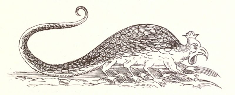
A Map from 1897 showing the Roman Empire with provinces, in 150 AD. (Photo: Public Domain/WikiCommons)

Roads, built to allow the empire to flow outward, and for the rewards of empire to come flooding back to the capital, were the key to the Romans' governance of Europe. Along these roads ran messengers, as a type of precursor to the American Pony Express—a relay of horsemen could carry a message 50 miles a day. Governors, emperors, legions, and, most importantly, trade flowed along these ribbons of stone that cut through hills and across gorges. In 9 BCE, the Emperor Tiberius rode almost 215 miles along the roads in 24 hours to get to his dying brother's side. For a small toll, other, non-official travelers could travel the roads as well.

article-image
Inside the Colosseum, Rome. (Photo: Philip Capper/WikiCommons CC BY 2.0

Roman roads are still visible across Europe. Some are built over by national highway systems, while others still have their original cobbles—including some of the roads considered by the Romans themselves to be the most important of their system.

article-image
Via dell'Abbondanza in Pompeii (Photo: Mentnafunangann/WikiCommons CC BY-SA 3.0)

One major road you can still visit is via Appia, or Appian Way, the most strategically important of the Roman roads. Begun in 312 BCE, the road runs from Rome southeast to the coastal city of Brindisi, a distance of 350 miles. It was via Appia that allowed for the Roman conquest of southern Italy, and the defeat of the Greek city-states and colonies embedded there.

The Appian Way was host to battles between the Romans and the Greek general Pyrrhus from 280 to 275 BCE, which is where we get the term "Pyrrhic victory:" a victory that comes at too high a cost. Via Appia was also the site where, in 71 BCE, around 6000 members of Spartacus's slave army were crucified on the hillsides.

The road also has more recent military history—it was the site of the 1944 Battle of Anzio during the Second World War, in which the Allies became mired in the same swamp that threatened to fell Pyrrhus two millennia earlier.

article-imageA Map showing the Appian Way and the shorter Via Appia Traiana. (Photo: Public Domain/WikiCommons)

In France (Gaul) and Spain (Hispania), the road systems were no less impressive than in Italy—the Alcantara Bridge, over the Tagus River, was built in 106 AD, and carries the inscription "Pontem perpetui mansurum in saecula," or "I have built a bridge which will last forever." This is not strictly true. While the bridge still stands, it was damaged, first by Moors in 1214, then by the Spanish in 1762, and again in 1809. There are, in fact, two bridges in Spain named Alcantara, built by the Romans, and a third, similarly named bridge, the Alconetar Bridge—all of which span the Tagus, in Western Spain. The word "Alcantara" comes from the Arabic word "al-qantarah", which means "bridge".

article-image
The Alcantara Bridge across the River Tagus, Cáceres Province, Extremadura, Spain. (Photo: Dantla/WikiCommons)

The Romans also acquired roadways and Latinized them—the via Domitia, which ran between Italy and Hispania through southern France, was an ancient path that the Romans paved in 118 BCE. Prior to the Roman upgrade, the path featured in Greek mythology as the legendary route of Heracles when he drove the cattle he stole from Geryon along it. This road was also the one travelled by the Carthaginian general Hannibal when he invaded Italy in 218 BCE. Along the via Domitia lie the remains of two bridges, one of which, the Pont Julien, is passable to foot traffic. The other, the Pont Ambroix, is ruined but beautiful.

article-image
Pont Ambroix. (Photo: Xabi Rome-Hérault/Wiki Commons CC BY-SA 3.0)

Along the Roman road via Julia Augusta, which also runs through the south of France, there are the remains of a number of bridges. The Pont Flavien is in the best condition, and is perhaps the most archaeologically important: it is the only surviving example of its kind of bridge, and was constructed as a funerary monument. It was heavily used until the end of the 20th century, and has been extensively repaired. Pont Flavien has sustained a lot of damage in the last few hundred years—part of it collapsed in the 18th century, and, during the Second World War, both a German tank and an Allied truck crashed into one of the archways. The bridge is now reserved for foot traffic.

article-imagePont Flavien on the Touloubre river in Saint-Chamas, France. (Photo: Carole Raddato/flickr

article-imageThe detail of a lion atop the Pont Flavien. (Photo: maarjaara/flickr

Then there are the world famous archways of the aqueduct that crosses the Gardon River, the Pont du Gard. Built in the first century, the aqueduct and bridge stand in such good condition due to their being used as toll roads during the Middle Ages. Originally the bridge was used for vehicular and pedestrian traffic, but access is now restricted to pedestrians.

article-imageThe vast Pont du Gare near Nimes, France (above) and below, a closer view of the existing structure. (Photo: Oleg Znamenskiy/shutterstock.com)

article-image(Photo: Andrea Schaffer/flickr)

In contrast to Hispania and Gaul, the Roman Empire never made much headway into Germania. Much of the Roman road network in the former Britannia has been built over or has decayed. Beginning their work in 43 CE, alongside the invasion organized by the Emperor Claudius, the Romans quickly built a road network through the lands they controlled in Britain. Although parts of this network remained in place, most roads quickly decayed after the Roman withdrawal. Modern roads cover much of the network—an example is the M20 motorway in Canterbury, beneath which lies a road known as Stone Street. There are ruins of bridges still visible, such as in Northumberland, where parts of Hadrian's Wall and Chesters Bridge can be seen, as well as in Durham, at Piercebridge.

article-image
A map of Roman roads in Britain. (Photo: Public Domain/WikiCommons)

Few roads remain in Germany, but the oldest still-standing bridge in the country is of Roman origin: the Manfred Bridge, in Trier. A UNESCO World Heritage site, the bridge spans the river Moselle, near the German border with Luxemburg. It is believed to date from the second century CE.

If we head east, through Dalmatia (modern Croatia) and Thracia (parts of modern day Greece, Bulgaria, and Turkey), we can travel Roman roads like the via Militaris, which ran from what is now Belgrade to what is now Istanbul. A section of the road is today visible in Dimitrovgrad, Serbia.

By taking the via Pontica you can see the craggy, ruined remains of Trajan's bridge, which was built in 103 CE to cross the Danube in Romania. Much of it was destroyed by Trajan's successor, Hadrian, as a precaution against invading hordes.

article-image
An artist's interpretation of Trajan's Bridge from 1907. (Photo: Rapsak/WikiCommons CC BY 2.0)

In Turkey there are still some Roman roads and bridges, like in Cilicia, or at Cendere Cayi, where the Severan Bridge steps 112 feet across the creek. Throughout Asia Minor and the Middle East ran a number of Roman roads, sometimes their own creations, other times imposed on top of existing roads. The via Maris (which translates to the "way of the sea") connected Aegyptus (Egypt) with Syria, Palaestina Judae, Cappadocia and onto the rest of the Empire. It traces an ancient trade route that was in existence from the early Bronze Age, and was originally called the Way of the Philistines. The via Regia (later the via Traiana Nova) was also built on an ancient trade route—the King's Highway, which stretched between Egypt and Damascus. The most well-known Roman road in the Middle East, however, was built in the first century, and leads to Petra, through the gates of the city.

article-image(Photo: Dennis Jarvis/flickr)

There are also a number of Roman bridges in the Middle East. Band-e Kaiser (Caesar's Dam) was a Roman bridge and dam built by contracted Roman workers in the third century CE. It is the easternmost Roman bridge and dam, as Iran was, at that time, part of the Persian Empire, not the Roman one. According to legend, Shapur I captured the Roman Emperor Valerian circa 257 CE, and forced him and his army to build the dam and bridge. This is what remains of it now:

article-image"Caesar's Dam". (Photo: Public Domain/WikiCommons)


The Princess Who Kept a Pet Lion at the Plaza Hotel

0
0

article-image
The grave of Goldfleck the lion cub. (Photo: Ella Morton)

Every gravestone at Hartsdale Pet Cemetery in New York represents the story of a remarkable and beloved animal. There's Woodstock, a cat so docile he was often mistaken for meatloaf. There is Speculaas, Who Left No Ball Unchased.

And then there is perhaps the most intriguing grave of all: Goldfleck, a lion cub who once belonged to a Hungarian princess.

Goldfleck, who passed away in 1912, was the short-lived but sorely missed pet of Princess Elisabeth Vilma Lwoff-Parlaghy, a woman whose life was full of art and adventure. Parlaghy was born in Hungary sometime between 1863 and 1867—though her birthdate is often quoted as April 15, 1863, the New York Times lauded her as an artistically talented woman of "not yet thirty" in July 1896. Raised in Hungary and Germany and educated at the Academy of Arts in Paris, Parlaghy began to attract the attention of the Paris, Berlin, and Vienna art worlds in 1891 with a striking portrait of her mother, the Austrian Baroness von Zollerdorff.

article-imageElisabeth Parlaghy's portrait of her mother, Baroness von Zollerdorff. (Photo: Public domain/Wikipedia)

Within a few years, Parlaghy's portraits of European royals were being exhibited internationally, including at the 1893 World's Fair in Chicago, where the art jury awarded her a gold medal. “Few men to-day among the world’s portrait painters have so large a way of looking at nature or a broader manner of expressing form," wrote the New York Times of her portraiture on July 12, 1896. "She sweeps in her subject in big, vigorous brush strokes, and she models with great freedom.”

article-image
Parlaghy's portrait of Wilhelm II, German Emperor and King of Prussia. (Photo: Public domain/Wikipedia)

At that time, Parlaghy was nearing the end of her first visit to the United States. The Times, clearly charmed by her many attributes—"graceful in figure, animated in features and conversation, and, like many of her race, a rare linguist," the article boasted—was not shy about expressing its hope that Parlaghy would return to America.

“The woman, her career, youth, personality, and the astonishing success with which she has met altogether make her an interesting figure in the art world," wrote the Times. "[T]he possibilities of her future are practically unlimited … we may expect great things.”

Great things did indeed follow, and not just in the artistic realm. In 1899, Parlaghy married Russian Prince George Eugeny Lwoff, thereby becoming a royal herself. The union lasted just a few years, but Princess Lwoff-Parlaghy managed to retained her royal title—and much of her royal riches—post-divorce.

 article-image
The princess's self-portrait. (Photo: Public domain/Wikipedia)

By 1908, Lwoff-Parlaghy had taken the plunge and relocated to the United States. In addition to having further honed her portraiture skills over the years, the princess had cultivated her love of animals. On June 20, 1908, the Timesreported that Lwoff-Parlaghy, now attended by an entourage, was "living quietly in a little cottage at Hot Springs, Va., where she is to be seen hovering about the verandas caressing strange pets." 

The next day, the Times printed a more thorough inventory of the princess's human and animal companions:

“Attending the Princess were two attachés, two couriers, a footman, first and second butler, first and second lady’s maid, a cook, a valet, a Swedish nurse, and last but not least in the affections of the Princess, her assortment of animal pets, consisting of a small fluffy Pomeranian dog, a smaller Angora cat, a guinea pig, an owl, two small alligators, and a bear.”

Though New York may have seemed the obvious choice for an artistic, single European princess looking to live in luxury, a few logistical factors prevented Lwoff-Parlaghy settling into the city that never sleeps. The princess sought a hotel that would cater to her royal whims while accommodating her menagerie. Rumors of Lwoff-Parlaghy's extravagant tastes were committed to print, which didn't help matters. "Wandering Magyar Princess Threatens to Invade New York Hotels," blared the sub-heading of the June 20, 1908 Times article, which went on to say that her demands included "four white ponies and a gold-trimmed vehicle."

According to the Times, Lwoff-Parlaghy's people had been sending letters to the managers of New York's swankiest hotels, requesting a suite that would house the princess, six of her servants, and her ragtag family of fauna. The Waldorf-Astoria turned her down, but the one-year-old Plaza Hotel agreed to accept the princess and her unusual entourage. In 1909, the whole gang moved into a suite on the third floor.

 article-image
The Plaza Hotel circa 1910. (Photo: Detroit Publishing Company Photograph Collection/Library of Congress)

Lwoff-Parlaghy settled into life in New York, adorning her Plaza rooms with Persian rugs, Gothic art, and her own paintings. But despite the creature comforts, something was missing. Then, according to Curtis Gathje's book At the Plaza: An Illustrated History of the World's Most Famous Hotela trip to the circus showed the princess that she had been walking around with a lion-shaped void in her heart:

"[T]he princess fell in love with a lion cub she spotted at the Ringling Brothers circus; she tried to buy it but was rebuffed," writes Gathje. "Determined to have it, she came up with a plan: One of her recent portraits depicted Civil War hero Gen. Daniel E. Sickles (also a figure of some renown at the time), and she convinced him to ask Ringing Brothers for the cub, knowing they couldn’t refuse him."

This canny plan worked: the Ringling Brothers were guilted into handing over their lion cub to Sickles, who had lost his right leg to a Civil War cannonball at Gettysburg. Sickles then presented the lion to Lwoff-Parlaghy as a "gift," as though the idea had popped into his head on a whim.

 article-image
Daniel Sickles, fellow animal aficionado. (Photo: George Grantham Bain Collection/Library of Congress)

The young lion's official name was Sickles, but the princess took to calling him Goldfleck. Tame but energetic, Goldfleck moved into the third floor suite at the Plaza, where he spent a lot of time hanging out in the giant bathtub of the main bathroom. (There is a delightfully evocative but poorly documented rumor that Lwoff-Parlaghy christened the lion by pouring a glass of champagne on his head.)

A trainer was on hand in case the lion became too rowdy, but Lwoff-Parlaghy liked to tend to Goldfleck herself. For exercise, she took him on leashed walks through Central Park. Despite the luxury amenities at the Plaza and the opportunities to stretch his legs and get some fresh air in the park, Goldfleck seemed to be faring poorly. In 1912, he passed away. Heartbroken, the princess conducted a funeral ceremony in her Plaza suite before journeying to Hartsdale and burying the beloved cub at the pet cemetery. Goldfleck is still the only lion to be interred at Hartsdale in the cemetery's 119-year history.

 article-image
Hartsdale Pet Cemetery. (Photo: Ella Morton)

After Goldfleck's death, things began to go awry for Princess Lwoff-Parlaghy. The arrival of the First World War decimated her family fortune, and in 1914 she was asked to leave the Plaza, having racked up too much money in unpaid room fees. According to the New York Times, her paintings were held as security against the debt. 

By March 27, 1914, the Times had begun to acknowledge Ms. Lwoff-Parlaghy's mercurial nature, taking note that in April 1910 she "slammed the door of her private elevator in the face of the Duchess of Manchester.” Further tales of her fractiousness followed:

"She has figured in many stirring episodes, including a wild night ride through Connecticut in an auto after she had abandoned a private car on a New Haven train, in which she did not get the privacy she desired because other passengers passed through it in going to the dining car.”

Things had gotten tumultuous, but Lwoff-Parlaghy still managed a triumph with her artwork: She managed to convince the reclusive Nikola Tesla to pose for a portrait. Tesla, a man obsessed with hygiene and plagued with a pathological fear of women wearing pearls, believed it to be unlucky to sit for a painting. The portrait that Lwoff-Parlaghy created in 1916 remains the sole one for which he posed. The princess unveiled the artwork during a special reception at her post-Plaza home, located 20 blocks south on East 39th Street.

article-imageLwoff-Parlaghy's portrait of Nikola Tesla. (Photo: Public domain/Wikipedia)

Princess Lwoff-Parlaghy died on August 29, 1923, having faded from public view. “The last few months of her life no one heard from or about her," wrote the Times in April 1924. A report from the day after her death noted that “[n]othing remained of the pomp and of the gorgeously uniformed entourage which had surrounded the Princess in earlier days.” Still, she was buried at the Bronx's Woodlawn Cemetery in a manner fit for a royal: Dressed in blue and silver robes, her head adorned with a silver crown.

Reflecting on her life and times a few months after her death, the Times wrote: “A number of the more conservative members of old time New York society, as well as the newer and less sure, came, saw and were conquered by the Princess who had not only beauty, but charm.” Oh, and one more thing: "She loved animals."

FOUND: A Perfectly Round Chicken's Egg

0
0

article-image 
(Photo: Screenshot, via ABC7)

In Florida, one morning earlier this week, a woman named Tammy was preparing an omelet, when she found something strange—a perfectly round egg. Steve Holloway, her boyfriend, was the first to hear about it. From ABC News:

“She came running into the living room and said ‘Look what I found!’” he said. “I thought she grabbed a golf ball out of my bag to play a trick on me.”

This is not the first perfectly round egg to be found. In 2010, a chef in England found a round egg while working morning shift. Back in March, a British woman named Kim Broughton discovered that one of her chickens had laid a perfectly round egg—it sold on eBay for more than $700

Round eggs are actually less well-suited for the world than egg-shaped eggs. As Mental Floss explains, "If eggs were perfectly spherical, they would be more likely to roll out of a nest and break." And eggs that aren't egg-shaped aren't necessarily a good thing: they're associated with stress and overcrowding

The chances of finding a round egg are supposedly "one in a billion"—at least, that's the number that's cited in these round egg stories. If that's true, these marvels should appear much more often: according to the American Egg Board, just in March 2015, "shell egg production" in the U.S. was 7.42 billion. But usually egg sorting machines keep the round eggs from reaching the public. Apparently the powers that be think we just can't handle such mathematical perfection over breakfast.

Bonus finds: Hot lava flows, on Venuscreepy baseball statues

Every day, we highlight one newly lost or found object, curiosity or wonder. Discover something unusual or amazing? Tell us about it! Send your finds to sarah.laskow@atlasobscura.com. 


A Computer Put A Face On A 7,000 Year-Old Woman

0
0

article-image
 Fatimah Ramone? (Photo: Mohammad Reza Rokni, Archaeology Research Center)

What does a 7,000 year-old woman look like?

According to Iranian archaeologists, a little bit like a lost Ramone.

For reasons, both political and natural, Iran is one of the most challenging places in the world to conduct archaeological excavations, which is unfortunate because the country is rich with ancient history waiting just beneath the surface. In fact, there is so much ancient history in the country waiting to be discovered, that in November of last year, an archaeology student found a 7,000 year-old woman’s skull buried next to a wastewater plant.

Then they used computers to put her face back on.

As reported over at Iran’s Mehr News Agency (which, full disclosure, is literally operated by the Islamic Ideology Dissemination Organization) and Archeology magazine, archaeology student Mahsa Vahabi was digging around on some land near the Tehran Water and Wastewater Company when she found some ancient pottery. Judging by the remains and the supine burial position, they determined that the remains belonged to a woman belonging to a lost, 7,000 year-old culture.

Much of the archaeological wealth in eastern Iran dates back 5,000 years when the region was part of the long trade road between ancient Mesopotamia and points farther East, but the skeleton found on Mowlavi Street in Tehran is thought to date back even further. Researchers believe the ancient woman was a traveler from the ancient city of Shahr-e Rey (known today simply as Rey), who was simply stopping in the area.

 article-image
Soon to be a museum. (Photo: Islamic Republic News Agency)

Enter Mohammad Reza Rokni of Iran’s Archeology Research Center. Rokni wanted to know more about this new mystery woman and set out about reconstructing her in a computer. As he told Mehr News,

“The model was developed drawing upon the supine position of the skeleton to represent its true position when interred; to reconstruct the face we added a digital version of missing parts mounted on the 3D model; the prepared model was pinpointed in 11 points in face on eyes, nose, ears, chicks, lips, and chin, and then the digital texturing filled these pinpoints to give us a clear image of the face,”

Putting skin back on the bones is the easy part (they do it on the Fox show Bones almost every episode). Things got a little trickier with the long-since-disintegrated hair the ancient woman might have had. Rokni freely admits that the remade woman’s hair color and length was a simple matter of taste, however it wasn’t a complete guess. Using images found on pottery from the Cheshmeh Ali archaeological site (an ancient natural spring where people would relax, and merchants would wash their carpets), Rokni did his best to guesstimate what a standard hairstyle would have looked like at the time.

The site where the woman’s remains were found is now being preserved to be turned into a museum.    


The Living Nightmare of the Mayfly Invasion

0
0


article-imageMayflies emerge from the lake. (Photo: Kovacs.szilard/WikiCommons CC BY-SA 3.0)

On June 15th, central Pennsylvania was bombarded by a plague of biblical proportions. Emerging from the Susquehanna river at night, adult mayflies literally swarmed the roads outside of the towns of Columbia, Wrightsville, and Lancaster. Attracted to the bright streetlights on bridges, the insects perished en masse —creating a two-inch layer of dead bugs.

The bugs wreaked havoc. Police reported that three motorcycle crashes resulted from the slippery conditions created by the decaying mayflies, along with numerous road and bridge closures. They even had to employ snowplows to clear the bridges.

Columbia, PA borough fire chief Scott Ryno told the Lancaster Online:

"It was like a blizzard in June, except instead of snow, it was mayflies... Visibility was zero for maybe a quarter mile across the bridge. They were getting in our mouth. We had to close our eyes. We had to swat them away. Even when we got back, it felt like bugs were crawling on you."

A fluke event? Surprisingly, not really. Every year in June and July along rivers in the American Midwest and Southeast, thousands upon thousands of mayflies emerge from bodies of freshwater for a singular purpose: The continuation of their species. These ungainly creatures (basically just flying sexual organs) enjoy a singular night in their adult form dedicated to frenzied copulation, after which they lay eggs and die. And often, humans get to witness a night (or day) where flies fall from the sky like rain. 


Spending the majority of their lives underwater, mayflies hatch as larvae, and slowly undergo a transition to their adult form—a process called incomplete metamorphosis. These little guys spend up to four years (dependent on the species) foraging on algae, plants, and organic matter on riverbeds. 

Though unseemly, these larvae are crucial prey for a variety of freshwater fish. Migratory birds, especially those that feed on the mayfly nymphs while on their way to northerly breeding grounds, rely on the underwater critters to survive.

So you can probably live with mayfly larvae in the water. What probably makes you more uncomfortable, is this:

While this looks revolting, it is actually a positive ecological signal for the Susquehanna River. Mayfly larvae have delicate external gill structures, which causes them to die in polluted streams. Mayflies only hatch in mass proportions when the water is extremely clean, and they are used by ecologists as a key indicator species of the health of freshwater ecosystems. 

While mayflies occur all over the world, it's the particular species that reside in the American Midwest and Southeast that undergo a synchronized transition to their adult form, forming the massive hordes we all know and love. 

article-imageAdult mayfly close-up. (Photo: Mario Quevedo/Flickr)

Because adult mayflies only survive for a few hours at a time (some species don't even have working mouths), they must use the cover of darkness to avoid predators, and successfully mate before they expire. The swarms are an evolutionary advantage, ensuring that enough mayflies will successfully start a new generation. Their mass deaths are a boon for local predators - who clearly don't mind the pervasive smell of dead fish emitted from the decaying piles.

Some swarms are so huge, they actually show up on weather radar, like this one from La Crosse, WI in July of 2014:

article-imageRadar map of mayfly swarm. (Courtesy of AccuWeather)

As renewed efforts to clean our waterways continue, expect to see more grotesque swarms of mayflies. So if you live near a river or lake in the Midwest, don't be afraid if you wake up and your car is crawling with flies.

In fact, you should be happy. This means that your local waterway is a healthy, thriving ecosystem that will continue to produce glorious swarms of insects, year after year. It seems that there's an upside to having your day interrupted by a storm of flies.

To see more about the lifecycle of mayflies, check out this short video from National Geographic:


An Illustrated Guide to Space Maps

0
0

article-image
Nebra Sky Disc, Germany, 1600 BC. (Photo: Rainer Zenz/WikiCommons CC BY-SA 3.0)

With its patinated bronze background and shiny gold sun, moon and stars, the 3600-year-old Nebra Sky Disc is worth gazing at for its beauty alone. But the ancient object is cool for a lot of other reasons: It’s the earliest depiction of outer space we’ve ever found, and it’s also thought to be the oldest known portable astronomical instrument.

For as long as humans have stared at the sky, we have sought to understand our place in the cosmos. This lovely orb is one of a long line of attempts of humans to map the unmappable—space. Scientists posit that the Bronze Agers who made the disc used it as an “astronomical clock” to correct for the shortcomings of moon-based calendars. Because the moon goes through twelve cycles every 354 days, not every 365, early agriculturalists had to throw in an extra leap month every once in a while to keep lunar calendars in sync with earthly seasons. They knew to add the extra month when the moon and the Pleiades were arranged “exactly as they appear on the Nebra sky disc.”

The story behind the disc’s discovery is almost as crazy as the disc itself: it was dug up by metal-detector- wielding treasure hunters in 1999, along with “two swords, two axes, a chisel, and fragments of armlets.” The looters sold the lot, and it made the rounds on the black market until someone tried to fence it to a Swiss “antique collector” who turned out to be a police officer pulling a sting. They were arrested, and the state claimed the disc, which has since been declared an official UNESCO “Memory of the World” object.

Is it art or science? Hard to say. Below is our roundup of the most marvelous attempts at mapping space, from 1600 BC to the hyper-precise satellite depictions of the modern era. 


article-image
From the
Harmonia Macrocosmica, Holland, 1660. (Photo: National Library of Australia/Public Domain)

Compiled by the Dutch astronomer and mathematician Andreas Cellarius towards the end of his life, the Harmonia Macrocosmica is a masterpiece of 17th century space mapping. Following the Ptolemaic tradition of geocentric universes, the maps present the planets as nothing more than bit players in Earth's show. Representing the most up-to-date understanding of the laws of physics at the time, the positions of the planet are depicted on rotating paths, along with the sun, and, of course, the corresponding zodiac signs. The Harmonia itself is considered to be one the best examples of celestial cartography—the practice of mapping stars and planets on a sphere - until the practice was moved to the fringes of astronomy as our scientific capabilities increased. 

article-image
From the Harmonia Macrocosmica, Holland, 1660. (Photo: WikiCommons/Public Domain)


article-image
"Idea dell'Universo." Vincenzo Coronelli, Italy, 1683 (Photo: WikiCommons/Public Domain)

Vincenzo Coronelli was a Franciscan monk who moonlit as a cartographer for the Republic of Venice. He designed at a variety of scales, from a series of “pocket-sized globes” to a couple of behemoths for Louis XIV that measured thirteen feet across and had trap doors built into them so craftsmen could work on them from the inside. The colorful “Idea dell’Universo” is a guide to both geographical and spiritual concerns, with subsections dedicated to everything from a theory of eclipses (in the middle of the left column) to a cross-section of Earth that includes Dante’s circles of hell (the large inlay at the top).


article-image
"Systema Solare et Planetarium." Johann Doppelmayr, Germany, 1742 (Library of Congress)

This plate, from the compendium “Atlas Novus Coelestis in quo Mundus Spectabilis” (which translates, roughly, to “New Atlas of Heaven in which You All Will See the World”), illustrates a melding of disciplines, time periods, and minds. Commissioned by famous cartographic publisher Johann Baptist Homann, it was designed by Johann Doppelmayr, a math professor in Nuremburg, and annotated by the Dutch astronomer Christiaan Huygens, who is more famous for discovering Saturn’s moon Titan and inventing the pendulum clock. It’s a compilation that pays respect to old, debunked ideas even as it presents then-modern ones—check out Athena in the bottom right corner with a few Earth-centric models of the universe, as the huge sunburst that dominates the map leaves no doubt about the mapmakers’ Copernican stance.

And keep this in mind when you spot the limits of 18th-century knowledge—Neptune and Uranus are nowhere to be found, and California, on the map of the globe, is portrayed as an island separate from North America.


article-image

"Carte des diverses positions de la sphere, des systhèmes de l'Univers, des planettes, des eclypses." Jean-Baptiste de La Fosse, France, 1797 (Library of Congress)

This engraving, made by Jean-Baptiste de La Fosse for the geographer Charles Francois Delamarche, is another buffet of late 18th-century celestial knowledge: With its globes within globes, it shows what people knew, what they had moved past, and how they found all of it out. Once again, old masters get their due—Ptolemy, Copernicus, Tyco Brahe, and Descartes each get a diagram for their preferred arrangements. Up at the top, each planet has its own illustration, as do the sun, the concept of refraction, and Earth’s, Jupiter’s and Saturn’s moons. Curiously, most space is dedicated to drawings of three-dimensional instruments—claw-footed globes of the land and constellations, and a big “armillary sphere,” which helped people determine latitudes and longitudes using the positions of the stars.


article-image
"The Solar System & Theory of the Seasons." Adam and Charles Black, London, 1873 (WikiCommons/Public Domain)

Adam and Charles Black had a monopoly on knowledge. Their publishing house, A&C Black, puts out medical dictionaries, almanacs, travel guides, and an annual Who’s Who. With “Solar System & Theory of the Seasons,” published in their General Atlas of the World, they moved beyond earthly concerns. On the left side, we get a comprehensive view of our space neighborhood—carefully drawn orbits of the planets (minus Saturn, Uranus or Neptune, which are left out “on account of their great distance”), orbital velocities, the contributions of notable comets, and even comparative sizes of the sun as seen from different parts of the solar system. On the right side, there’s a guide to the many ways in which our neighbors affect us, from lunar phases and tides to the four seasons and “twilight and dawn.”


  article-imageFlat-Earth map by Orlando Ferguson, South Dakota, 1893. (Orlando Ferguson/WikiCommons/Public Domain)

With all of the new technology developed during the Industrial Revolution, our tools for observing the night sky became much more precise. By the end of the 19th century, scientists had long determined that the Earth wasn't actually the center of everything, and that the universe is larger and infinitely more complex than they could ever imagine. 

However, one persnickety "professor" took it upon himself to prove everyone else wrong. Professor Orlando Ferguson (a self-designated title), drew the Square and Stationary Earth Map for the express purpose of rectifying both scientific and biblical models of the world. What he came up with is this unique, inverse toroid (a fancy word for roulette wheel) shaped Earth, with the Moon, North Star, and Sun held in magnetic attraction by the North Pole. Harkening back to the celestial maps of old, Ferguson included four angels standing guard at each corner. He travelled around the Midwest touting his map by giving wide-ranging lectures and quoting the Bible verses that supported his theories. 

As for what Ferguson thought of the scientists who made precise calculations about the shape of the Earth and the speed in which it rotates, he included some very telling imagery of men struggling to hold onto the planet as it zooms around, with the inscription: 

"These men are flying on the globe at a rate of 65, 000 miles per hour around the sun, and 1,042 miles per hour around the center of the earth (in their minds). Think of the speed!" 


So you've seen what people thought the universe looked like through various historical epochs. This is what it looks like now. Astronomers at the Sloan Digital Sky Survey have been painstakingly mapping the night sky for almost fifteen years using satellite imagery. This video shows their latest data - and though it looks vast, it amounts to less than a third of the visible sky. 

A Sleep Researcher's Attempt to Build a Bank for Dreams

0
0

 article-image
John Henry Fuseli's famous painting 'The Nightmare', from 1781. (Photo: Public Domain/WikiCommons)

For many people, listening to just one person describe their dreams is a nightmare. But for G. William Domhoff, it’s a calling; as a dream researcher, he listens to them professionally.

But even a dream doctor has his limits.

“As soon as people find out what I do, they want me to interpret their dream,” says Domhoff, a research professor in psychology and sociology at the University of California, Santa Cruz and author of several books on dreams.

But dreams are a numbers game and Domhoff prefers to work with big data sets, not a single offering. Over the years he has collected and analyzed a vast library of dreams and is one of the founders of The DreamBank, an online archive of over 22,000 dreams. The database, which is available for the public to sift through, is an attempt to quantify one of the most ephemeral of human experiences.


Dream research really took off in the 1950s when rapid eye movement sleep, or REM sleep, was identified and connected to dreaming. Scientists once thought dreaming only occurred during REM; now it is believed it can happen at other times, too. (Domhoff is currently working on a book exploring the connection between “mind-wandering”—or daydreaming—and dreams.) This jumpstarted laboratory research in which sleeping subjects were awakened and asked to describe their dreams. Laboratory research remains a common way to collect dreams, along with asking students and other groups to record their dreams in diaries. But collecting dream data is inherently challenging. 

“You can’t make them happen,” says Domhoff.

And assigned dream journals carry their own risks.

“We’re always at the mercy of the participant whether they’re telling us accurately or not, whether they’re embellishing,” says Domhoff. For instance, a bashful subject may omit an amorous dream. 

article-image
Brain activations shown in a recent paper on Dreamresearch.net, during dreaming (left column), waking daydreaming (middle) and REM sleep, which is nearly always accompanied by dreaming (right). (Photo: G. William Domhoff/dreamresearch.net)

So what’s a dream researcher to do? Seek out dream records maintained by people for what Domhoff terms “their own reasons.” And many of the dreams deposited in The DreamBank are such documents.

There’s the diary of a widower who began writing down every dream he ever had about his deceased wife. (Domhoff devoted an entire paper to this diary.) The database holds 3,116 dreams from a woman who has been recording them since 1977. Another dreamer, “Dorothea,” contributed 900 dreams recorded over 53 years, starting in 1912.

The bank has its roots in records Domhoff inherited from his mentor, Calvin S. Hall, a psychologist who created a coding system for dreams that allows researchers to track things like recurring characters, activities and objects. Hall died in 1985 and his collection remained inaccessible to most. In 1999, Adam Schneider, a student of Domhoff’s, suggested that they could put the texts online and make them searchable. The DreamBank was born and current collections were added to Hall’s historical ones.

article-imageProf. G. William Domhoff in conversation with psychologist Calvin S. Hall at the University of California in 1968. (Photo: Courtesy Special Collections/ University Library/ UC Santa Cruz

 The archive is organized in 73 dream sets. Most of those sets are dreams collected from an individual, but some are from groups who were assigned to keep diaries, such as blind dreamers and Swiss schoolchildren. Over the years, people have heard about The DreamBank and submitted their privately kept journals to be preserved and made available to readers. Domhoff believes in granting anonymity to dreamers, and many of the pseudonyms in The DreamBank are both colorful and descriptive such as “Pegasus: the factory worker” and “Toby: a friendly party animal”.

Since the bank went online, several researchers have used the data to conduct studies into dreams. And the current iteration might only be the start: Domhoff believes today’s smartphone technology may be the key to amassing even more dream data, and he’s not the only one. In 2014, Hunter Lee Soik, a former freelance creative director, crowdsourced $82,500 to build an app that people could use to record their dreams and then send them to a database for coding. Just like Domhoff, Soik hopes that giving researchers access to data will help them better understand dreaming.


So what is it like to read through the bank? In a sense it’s like being a room full of people who are telling you their dreams. The narratives are simultaneously strange, dull and absorbing.

Toby, for instance, often dreams of attractive women and smoking weed: 

All the sudden we've stopped to get dinner and then all the sudden I'm at the front of the line looking at the cashier. She's a redhead with straight hair and a really hot face and straight, perfect white teeth. I look up at the menu and recognize it as Jack-in-the-Box. For some reason I'm confused and am having a hard time ordering. She notices and I look up at her and say, "I'm not having a hard time ordering because I'm high, okay," and she looks at me sexually and says, "That's okay, take your time."

The dreams are searchable by keyword. Here’s a dream about 12-year-old “West Coast Girl” had about a cat:

I saw a light outside and I saw a UFO. Out came ET and he points his middle finger at me and said "phone home." My sister came out with my cat and screamed. ET took my sister and I was very happy. Then he took my cat and I was mad so I threw a huge rock at ET and ET disappeared. Then it was the morning and my sister and my cat were home so I went to Safeway at about 2:00 and I saw Billy Joe Armstrong [sic]. I asked him for his autograph but he ran away. His parents were there.

Famous people make cameos: Candice Bergen, Kiefer Sutherland, Bill Murray. Ed, the widower who recorded only dreams of his deceased wife Mary, dreams that she and Jerry Seinfeld abandon him while on an outing: “I am bored because I have nothing to do, and angry at Mary and Jerry for deserting me.”   

article-imageA Chart of the neural network for dreaming, which is still being refined and researched. (Photo: G. William Domhoff) 

article-image
Areas of the brain that are believed to not be active during dreaming. This is, as Domhoff says, a "first draft" of scientific research. (Photo: G. William Domhoff) 

So, after combing through decades of data, can Domhoff interpret our dreams? Well, yes and no.

First of all, Domhoff understands the urge to assign meaning to dreams. 

“Dreams are so real,” he says. “Uncle Frank is sick or Nancy slapped Betty, we want to make sense of them. We can’t see it as random.”

But there’s a lot of “noise” in dreams, says Domhoff. In order to even begin parsing the meaning of a person’s dreams, Domhoff would need lots of dreams from that person—not just a single, memorable one. And, while many cultures have ascribed fantastic possibilities to dreams from diagnosing illness to predicting the future, Domhoff’s assessment is a bit more sober. Dreams, he says, are an expression of the same thoughts and concerns expressed in our waking life.

“If you never got over Joe, you’re still bitter, angry or still love him dearly then Joe’s going to keep popping up,” says Domhoff.

In other words, you aren’t the only one dreaming about work. As for Domhoff, it’s hard to say what he’s dreaming about. The researcher doesn’t remember most of his own dreams.

The Myth of the Bamboo Pentagon: The Vietnam War's Phantom Enemy Headquarters

0
0

article-image
 (Image by Eric Grundhauser)

The Vietnam War had any number of controversial battles, but the invasion of Cambodia stands out—an unnecessary, bloody move that cost the lives of hundreds of U.S. soldiers on the ground and led to widespread rioting at home, including the Kent State tragedy.

Remarkably, a new book based on information from recently released documents confirms that one of the key rationales for this act was a mirage, a conspiracy theory. President Nixon had embarked on a mad hunt for the “Bamboo Pentagon,” a shadowy headquarters and command center from which the Communist forces were directing their side of the fighting. This is how Tim Weiner described it in his new book, One Man Against the World: The Tragedy of Richard Nixon:

The Joint Chiefs of Staff claimed to have located the enemy’s headquarters inside Cambodia — what the United States called the Central Office for South Vietnam, or COSVN. The chiefs envisioned it as a ‘Bamboo Pentagon,’ concealed beneath the jungle’s canopy. They thought that if you could blow up this central headquarters, you could cripple the enemy’s capacity to command and control attacks on U.S. forces in South Vietnam.

McCain said the United States should destroy it and win the damn war.

It was Admiral John McCain's gung-ho assessment, given to a sleep-deprived, and desperate President Nixon, that served as a pinpoint to focus on in the increasingly obtuse politics of the situation in Vietnam. The reality of the situation was that the People’s Army of Vietnam and Viet Kong leadership was more compartmentalized and mobile, and it’s possible (even likely) that there never was any secret jungle complex. Regardless of this, Nixon ordered ground troops into Cambodia on April 29th, 1970.

article-image
"Maybe this "Bamboo Pentagon" is around here somewhere." (Photo: National Archive/Wikipedia)

A total of 13 operations were conducted during the incursion, with American and South Vietnamese fighting against the People’s Army, the Viet Kong, and the Khmer Rouge. With domestic reaction to the Cambodian offensive deafeningly negative, the invasion was abruptly discontinued on July 22, 1970. (The first raid was called “Operation Breakfast”; with later missions of "Lunch", "Snack" and "Supper" that went under the eventual name of “Menu”.) Nonetheless, Nixon crowed about the operation being one of the most successful engagements of the war since they were able to somewhat disrupt Communist power in Cambodia. Of course, this invasion also paved the way for the rise of the genocidal Khmer Rouge, who turned Cambodia into a horror show of torture during the late 1970s.

What the Cambodian campaign certainly did not do was locate the fabled Bamboo Pentagon. No evidence of the military evil lair was ever found. Some, though, continued to carry a torch for the place even after the war: Just because the Bamboo Pentagon was never found, that doesn’t mean something like it didn’t exist. In a declassified 1978 interview with Richard Helms, who served as Director of the CIA during the Vietnam War, he describes the quest for the Bamboo Pentagon:

“They were looking for but never found something called ‘COSVN’ which was the North Vietnamese Command of the forces in South Vietnam. The CIA had no illusions of a ‘bamboo pentagon.’ We knew that there was kind of a command structure which may have been no more than a General and two or three aides and maybe a table that moved from place to place, but you can't run armies without communications and without a headquarters.

If President Nixon had kept the American troops in the area longer and really had cleaned it out, as the operation was designed to do, I think we would have found a lot more. But the operation started and then stopped suddenly and the troops withdrew because of domestic pressures in the United States. It is hard to say today that there was no headquarters in there just because we didn't find it.”

It may never be known whether the COSVN ever existed as a military center underneath a jungle canopy or not, but the Cambodian invasion's scars continue to be very real.  

FOUND: A Baby Buried With a Bishop 350 Years Ago

0
0

article-image
Bishop Winstrup (Photo: Gunnar Menander)

Back in the 17th century, Bishop Peder Winstrup was one of the luminaries of Lund, Sweden—he was a scientist and theologian who help start Lund University in 1666. When he died in 1679, his coffin was filled with a deep layer of herbs—juniper, wormwood and hops—which helped make his body one of the best-preserved from that time. (His tufty beard is still on his mummified face.)

Recently, scientists in Lund decided to use modern technology (CT scans) to further investigate Bishop Winstrup’s remains, but when they scanned his coffin, they found a surprise, the Guardian reports.  Beneath his feet, under the herbs, there was another body—a tiny baby, likely born prematurely, at just five or six months. 

It was, the scientists report, “deliberately concealed under [the bishop’s] feet at the bottom of the coffin.” It’s not clear if the baby had any connection with the bishop; one theory is that the tiny corpse was snuck into the coffin, because the baby otherwise would not have been buried on Christian ground. 

Bonus finds: A 12,000-year-old puppy, a missing lionthe largest outdoor pot farm ever discovered in Virginia

Every day, we highlight one newly lost or found object, curiosity or wonder. Discover something unusual or amazing? Tell us about it! Send your finds to sarah.laskow@atlasobscura.com. 

Basically Every City in the U.S. Has a Piece of the Berlin Wall

0
0

article-image
Checkpoint Charlie. (Photo: Norbert Aepli on Wikipedia

June 22, 2015 marks 25 years since the official closure of Checkpoint Charlie, the best-known crossing point of the Berlin Wall. During the Cold War, this gateway was the only place where non-German tourists and diplomats could cross between Allied-administered East Berlin and Soviet-controlled West Berlin. Over the decades, Checkpoint Charlie witnessed much East-West tension, a 1961 stand-off between American and Soviet tanks, and occasional outbursts of violence—in 1962, 18-year-old East Berlin resident Peter Fechter was gunned down by border guards near the checkpoint while attempting to cross to the west.

Visit the site now, located in Berlin's Friedrichstrasse, and you'll find a replica guard house manned by actors in military uniforms who, for a Euro or two, will gladly pose for a photo with you. Take-out eateries such as Snackpoint Charlie peddle "Allied hot dogs" and "checkpoint curry sausage." Souvenir shops and street stands sell matchbox-sized chunks of colored concrete that they claim are absolutely, definitely, 100 percent real bits of the Berlin Wall.

The authenticity of such concrete chunks may be dubious, but the idea of owning a piece of history is enticing. And at 96.3 miles long, the Berlin Wall was, and is, a colossal souvenir, able to be divided up and dispatched to memorial spots around the world. The United States scored some prime segments, many of which sit in public places. Here are a few of the locations you can see a section of the wall that divided Germany for almost 30 years.

Ronald Reagan Presidential Library, Simi Valley, California

article-image(Photo: mcflygoes88mph on Flickr)

It was only fitting that Ronald "Mister Gorbachev, tear down this wall!" Reagan should get to keep a section of that very wall at his presidential library. The butterfly-enhanced segment has been sitting in its al fresco exhibit spot since 1990.  

George Bush Presidential Library, College Station, Texas

article-image(Photo: FlickReviewR on Wikipedia)

Not to be outdone, George Bush, who was president at the time the Berlin Wall fell, has a hefty wall section at his own presidential library. The six broken wall segments have been incorporated into a sculpture in which five mighty horses bolt for freedom. The symbolism is clear.

Midtown Manhattan, New York

article-image(Photo: Michael on Flickr)

Paley Park, located at East 53rd Street and Madison Avenue in Manhattan, doesn't have any grass, and its few, thin trees are surrounded by concrete. The austere aesthetics may be stark, but they make ideal surroundings for a five-panel section of the wall, which sat in the courtyard from 1990. In September 2014, the wall had to be whisked away for restoration, having sustained damage from the waterfall behind it. Beginning in the summer of 2015, the restored wall section will live in the lobby of 520 Madison Avenue. 

New Yorkers are spoiled for choice when it comes to the Berlin Wall. Sections are also on view in Battery Park City, at the United Nations gardens, and at Ripley's Believe It Or Not in Times Square.

5900 Wilshire Boulevard, Los Angeles, California

article-image(Photo: Eden, Janine, and Jim on Flickr)

In front of the 30-story office building at 5900 Wilshire Boulevard is a 10-segment section of wall—the longest piece outside Germany. Los Angeles' Wende Museum, which is dedicated to preserving Cold War history, installed the section in 2009 as part of a public art initiative to commemorate the 20th anniversary of the wall being torn down. Five of the segments have original graffiti from when they sat in divided Berlin, while the other five were painted in 2009 by artists Kent Twitchell, Farrah Karapetian, Marie Astrid González, and Berlin-based Thierry Noir, who also painted on the wall during the 1980s.

Hilton Anatole Hotel, Dallas, Texas 

article-image(Photo: Danleo on Flickr)

The art collection at this swanky Hilton in Dallas includes a two-segment wall section covered in graffiti by Jürgen Grosse, also known as Indiano. Grosse, a former West Berlin resident, painted great swathes of the wall in 1989.

Portland, Maine

article-image(Photo: Ambernectar 13 on Flickr)

A triptych of wall segments sits at Long Wharf, right opposite DiMillo's Floating Restaurant, in Portland, Maine.

Western L Station, Chicago, Illinois

article-image

(Photo: Matthew Ginger on Wikipedia)

This slab of wall, located in Chicago's Western Brown Line L station, was a 2008 gift from Berlin in recognition of the United States' contribution to German reunification.

Miami Dade College Wolfson Campus, Miami, Florida

article-image(Photo: Phillip Pessar on Flickr)

On November 9, 2014, a crowd of 1,500 ate bratwurst and waved German flags as this wall segment was unveiled on Miami Dade College's Wolfson campus.

Viewing all 11432 articles
Browse latest View live


Latest Images